~Not quite 2022 more like 2007 spring and 2012 August
C is Cold Temperature North Pole, in green is the jet stream, dominant locations of cyclones and anticyclones are placed, the latter means more often than not you will see a High or a Low on the coming weather maps.
May to June 21, 2 CTNP zones, the Ellesmere Island one stronger of late, but the real cold imprint was from Northeastern Siberian CTNP's dominating during much of the winter. The Arctic Basin Gyre switchover will occur late, at around the solstice, which means a great potential strong melt North of Beaufort sea but this will be slowed by Cyclonic clouds. Rainy on the Northwest North American coast, but somewhat not diluvial since the great SST North Pacific warm blob is smaller than recent previous years. Northern Europe would have the benefit of clouds as opposed to the Mediterranean shores baking.
June 21 till mid September, sea ice direct sun melt reprieve with the Low pressure mainly hanging on top of the Arctic Ocean Gyre, along with North Pacific in provenance moisture, giving clouds, mitigating an otherwise disastrous start of the melt season. With steady stagnating weather over North America, where its hot will persist hot, where its moist will be soggier longer. It will be stubbornly cloudy for most of North of Russia Arctic ocean shores throughout the sea ice melt season. However disastrously hot over most of Siberia at some distance from the Arctic Ocean. Likewise extreme heat in Europe and North Africa. Not to be as bad in North America, because of the sea surface high temperature blob of the North Pacific injecting moisture eventually mixing with Gulf of Mexico evaporation for the East coast, proximity to El-Nino will add up favoring more clouds as well. Even with very slow to not moving systems, multiple heat waves will abound. Along with a very slow moving hurricanes and typhoons most having great strength , fortunately not as frequently landing to shore, with hurricanes and typhoons mainly wandering aimlessly over very warmed up ocean sectors, but those who do reach land will not be pleasant, with not much returning to normal after passage.
The ultimate test of understanding our present climate, sea ice projections.
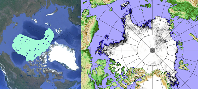
Ever so difficult to be exact, more so than any climate projection attempts, is the sea ice extent at minima , usually mid-September, here is a look at last years projection adjoined with 2022 actual JAXA extent on September 15:
2022 projection failed in morphology on the Russian Quadrant from the North Pole , not so much in over all extent. I am more confident about this years shape of sea ice minima perimeter to come:
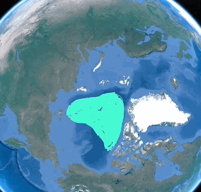
The 2023 minima should have finally less sea ice than 2012, despite the clouds
from El-Nino and the North Pacific blob, primarily because there will be a 2012 cyclonic repeats in August, and since the over all sea ice is thinner than ever. The NW Archipelago shores should appear more open at times because of the effects from these Arctic Ocean Gyre hovering cyclones, despite sea ice tendency of piling up or ridging on the archipelago coast by the tides. WD April 29. 2023


No comments:
Post a Comment