Saturday, May 21, 2022
EH2r Projection bang on, Arctic Basin Pressure switchover appears to be late
Monday, May 2, 2022
Very rare coincidence? EH2r projection in sync with most models.
~Sometimes AI gets it right
~EH2r projection just made in previous article really close to NOAA model even the Alaska bit
NOAA June July August summer outlook, amazingly in sync with EH2r summer
Sunday, May 1, 2022
Annual spring summer autumn circulation and weather projections deduced by mainly unorthodox means
~Amazing unusual past winter observations, from beginning to end
~Wild variances in Arctic climate was the main feature
~LaNina so mild not important as much as ENSO trending warm or cold
~Unfamiliar sudden changes in Arctic weather patterns are rapidly becoming the norm
The objective of this exercise is to see how much I understand weather dynamics in relation to geophysical observations lasting throughout the High Arctic autumn, the long night and spring. If I understand what happened well, I might have a very good idea what will become later.
Prognosis
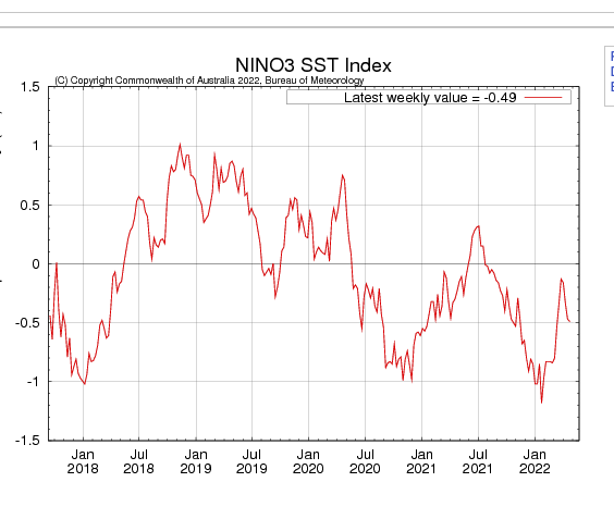
A rapid prognosis of past autumn and winter is essential, strangely ENSO pattern appears regular since summer 2020:
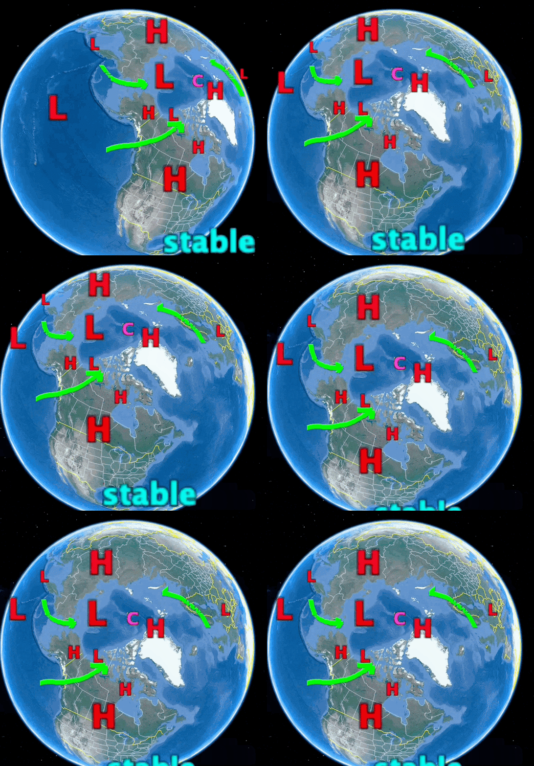
May 1 to about July 15
July 15 To August 15
August 15 to September 25
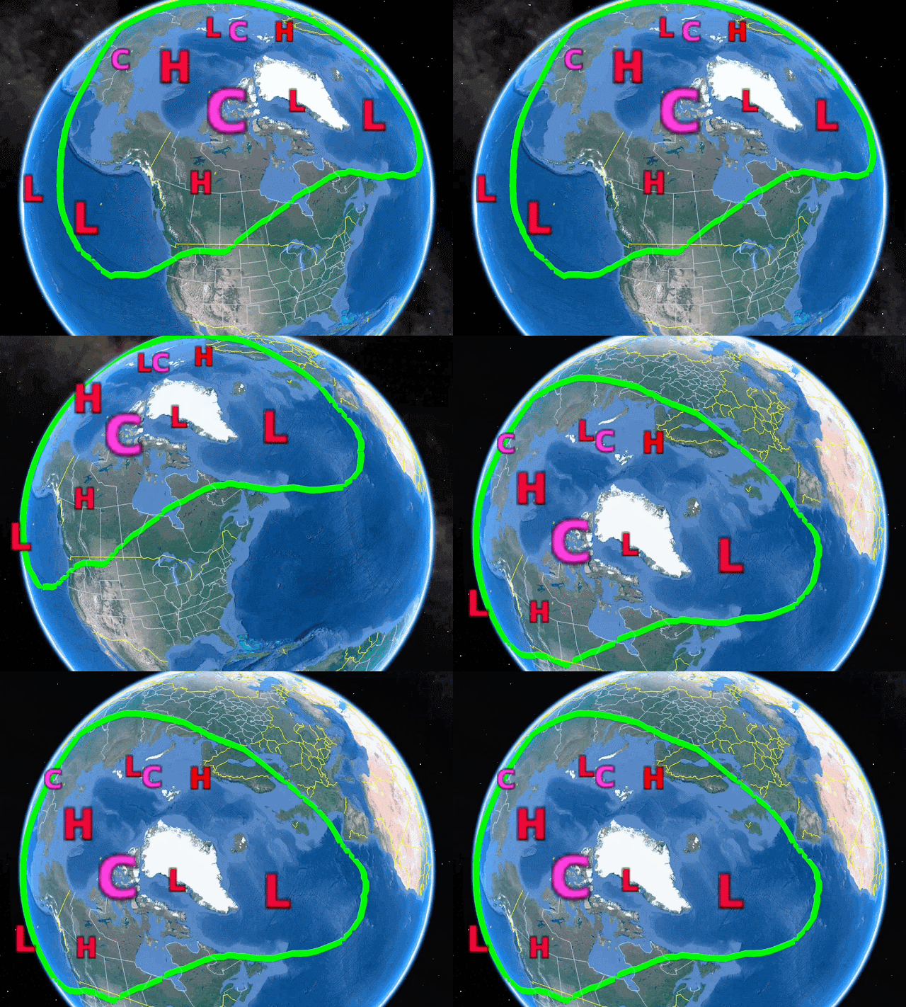
The return of a bit of a Polar jet stream will come as the sun lowers to elevations not so warming, the Cold Anticyclone will be nearer Greenland as to hug what sea ice remains. Siberian Cold Temperature North Pole will faintly appear, along with North Greenland and Ellesmere Island cold temperature vortice. Note the vortices help form the north Pole anticyclone. while this North Pole High grows, a North Atlantic High will extend Southwards, making the East North American coast vulnerable to hurricanes. Most of sea ice will appear to melt suddenly later than usual, and the rebound freeze up will be very sluggish.Arctic Sea ice minima
Sunday, April 17, 2022
Voyage at Center of Cold Temperature North Pole, temperatures decreased as the rest of the Northern World warmed
~All the latest exciting discoveries were encapsulated in the first 2 weeks of April 2022
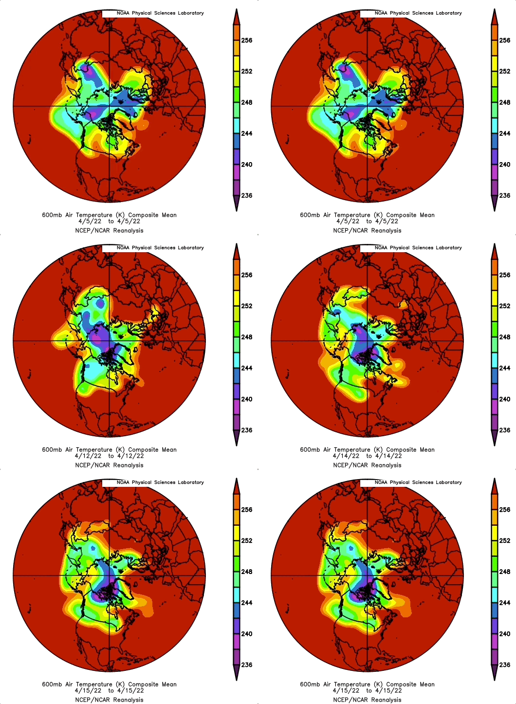
~ As the Northern Hemisphere warmed, the Polar Vortex shrunk with extending outwards waves, while the CTNP gradually returned to central Canadian Arctic Archipelago (CAA), making it deeply colder compared to 2 weeks prior.
~Vertical sun disks shrank accordingly, but also had some expanded sun disks, meaning Cold Temperature North Poles have very small horizontal extents.
~Absolutely astounding reversal of tropopause heights were noticed as well, the tropopause at CTNP center can be as low as 5 km.
Sunday, April 3, 2022
A Rogue extremely cold Vortice just flew by, an example of the new winter look for decades to come
~Winter may be officially over, but it said final goodbye in NE USA on March 28
~It was a Rogue Vortice, very cold Cold Temperature North Pole cut off from the Polar Vortex
~Expect more of these more often for many winters to come
The geometry of winter has changed, it has become thinner, not bloated by darkness as it use to be. In effect, winter still rages but for smaller areas, when so
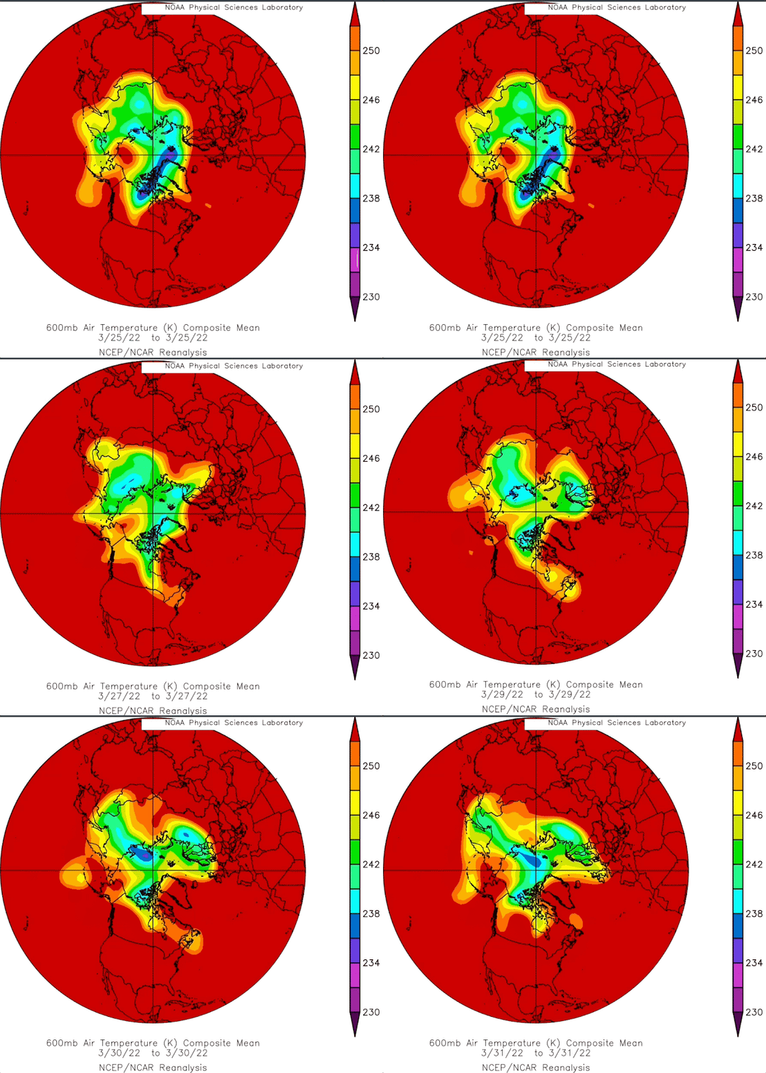
the vastly larger stable warmer air deepens the Cold Temperature North Pole(s), not often at the North Pole, but wherever it may be. Sometimes very surprisingly, like a few days ago as on March 28 over Michigan USA, suffering again a cold blitz, something special makes it there, perhaps it’s the location tip of the elongated end of the Polar Vortex, stretched out with favorable cooling weather twinned with some cold air advection. At any rate, being in late March, such a low latitude CTNP has no chance of living long, as it did so.
However the geometry is of interest:
Monday, March 21, 2022
Sun disks confirm anomalous Arctic warming
~Especially away from the Cold Temperature North Pole
~Presently in the extreme Northern Arctic lands of Ellesmere and North Siberia
It took a while , more extensive cloud cover slowed data acquisition, but today help gathered more than 50 sun disk measurements having a remarkable 20% result of vertical sun disks being above all time highest decimal averages. 5% is considered normal random result, indicating no warming or cooling of the atmosphere. 20% is 4 times above normal. Not seen like this since 2010 and 2016. Turns out there is a warming, particularly over the Arctic Ocean, not coming as a surprise given the thinner sea ice:
https://www.theguardian.com/environment/2022/mar/21/extremes-of-40c-above-normal-whats-causing-extraordinary-heating-in-polar-regions
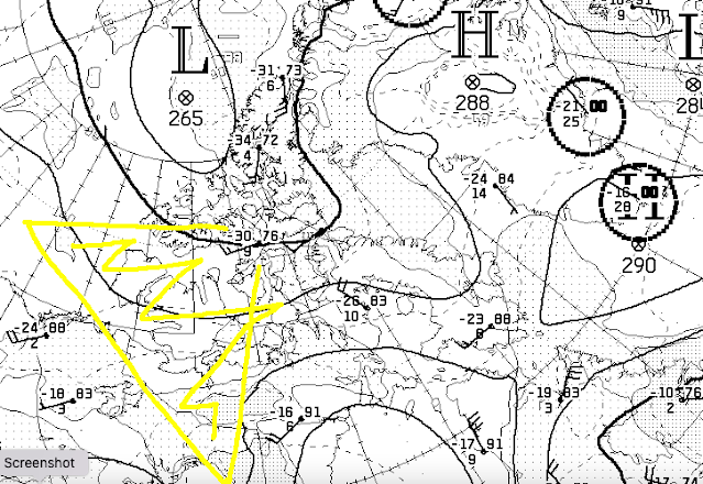
Indeed , all time high temps coincide with increasing clouds and the perpetuation of North Atlantic and Pacific moisture well above the Arctic circle, this evenings CMC 700 mb chart shows where the heat was found to be, not only today but for about the last 2 weeks.
In yellow is the area where sun disks were measured. There was a significant CTNP off West central Greenland a few days ago, now the CTNP hovers above Ellesmere Island. The CTNP was much further South preceding West Greenland, it had no staying power because of proximity to the North Atlantic, CTNP migrated from Northern Quebec to West Greenland and finally central Ellesmere in about 8 days., all while flowing air from the Arctic Ocean basin southwards West of 90W degrees longitude. In the not so distant past, this would have meant a significant deep freeze in the same area in yellow. Vertical sun disks are far more sensitive to the temperature of the entire atmosphere, than at any particular altitude. At recent vernal equinoxes particularly 2018, 2019 and 20, the CTNP was situated above the central Canadian Arctic Archipelago, strongly shrinking vertical sun disks, 2022 equinox scene is different, more like 2017 and preceding years, when sun disks were much expanded and representing the whole Arctic. Measuring sun disks from center of CTNP gave a peculiar distorted view representing a stable center of extreme cold clear sky weather which was unique compared to past 17 years. Colder air, albeit smaller in extent, can subsist even when warming is almost overwhelming at every locations.Monday, March 7, 2022
CTNP moves; Siberia Canadian Arctic Archipelago back to Siberia
~ Winter 2021-2022 story to date, CTNP shifts from Siberian dominance to the CAA and returning to Siberia.
~ Canadian Archipelago recent dominance is fading fast.
The larger question throughout winter is always explaining the reason for Cold Temperature North Pole location at any given daily location. Turns out 2021 early winter Siberian dominance may have been caused by Arctic Ocean having more open water, hence more snow, onsets early winter there, On Canadian side of Arctic, winter was delayed by incredible warming and less snow, unusual considering last few years same periods.
Sunday, February 13, 2022
CTNP vortices avoiding Arctic Ocean sea ice , rapid warming of the Arctic transforms Polar Vortex morphology
~The speed of change is dramatic, considering average warming by 1 C average use to take hundreds of years.
~Arctic weather is morphing with respect to a warmer North Pole
We look at recent CTNP vortices, those coldest centers of the Polar Vortex, at 600 mb pressure level, representing the temperature of the entire troposphere, and find remarkable avoidance of the Arctic Ocean for having a Cold Temperature North Pole, as surmised in previous articles, they were interspersed, small, fleeting, if any at all, while similar over land at least lasting longer in duration or more stable:
Here we split the climate scenes made obvious in less than 30 years, one in the 1970's and the other in last few years. The contrast can't be more clear, since 2007, the Arctic Ocean seems to have been cleared of CTNP's, while in late 70's it was 5 February 11's out of 6 which had CTNP presence, rather than 1 out of 7 for 2007, 2016, 2018,2019 till 2022 same day. The importance of taking a single day is not trivial, since the area involved is huge, given same atmospheric chemistry, the odds are somewhere during the same day the temperatures would be similar. Arctic Sea ice not as thick, not as insulating from said but now warmer Ocean, giving a different circulation pattern for the entire Northern Hemisphere, which has not given pleasant or comfortable weather conditions in certain key locations of our planet. WD Feb 12, 2022
Sunday, February 6, 2022
When coldest of winter starts from the South, the new climate normal
~An Arctic perspective use to portray cold winds from the NORTH
~Now cold atmospheres start from the South
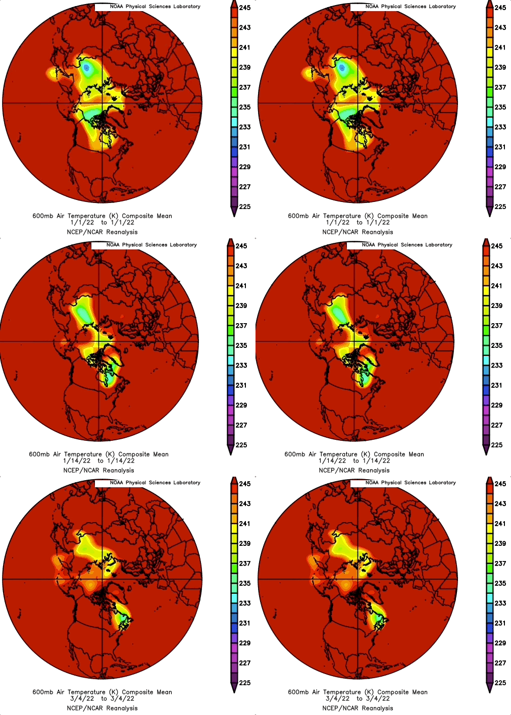
Pay attention to the High Arctic weighted temperature of the entire troposphere. At beginning of January till mid month the coldest air was further South, then after the Cold Temperature North Poles grew in size, the coldest temperatures finally settled in the High Arctic. This climate shift is recent. Basically implies a warmer Arctic, on land especially over thinner sea ice. Still implying the bulge of winter moved Northwards in several locations. Over the oceans and virtually on every part of the continents, whereas winter of old still exists but for much shorter time periods. On the North American side, the CTNP settling over the Eastern High Arctic give more often than not the warm winter periods of late. However the less expansive Cold Temperature Vortice centers on each continents make for dramatic weather changes, which make the news because these weather events are usually out of time and place. WD Feb 6 2022
Friday, January 28, 2022
Don't look UP .... North....... Arctic sea ice in dire straits (literally)
~Ridging sea ice against the Canadian Arctic Archipelago hardly exists!
These are strange days, when denialists and a few microphone Youtube presenters sway large segments of our population to believe in fantasy impressions of reality, even when evidence, not little bit of evidence, massive sways of archives occupy computer memory banks, instead of human minds.
To help up a few hesitant deniers, and to encourage them to do their own exploration, hopefully backed the writings of giants (found in any good science book) . Here is the Canadian Arctic Archipelago, just NW of its center, January 23 and below this for good measure 26 , 2022,
January 23 Polarview picture, the top one, looks very distressing, January 26 , same area, shows some freezing, which should be extremely strong in Polar darkness, it doesn't seem so here. For those who don't know about the Canadian Arctic Archipelago (ie CAA), I am not surprised, TV maps rarely depict them correctly:


