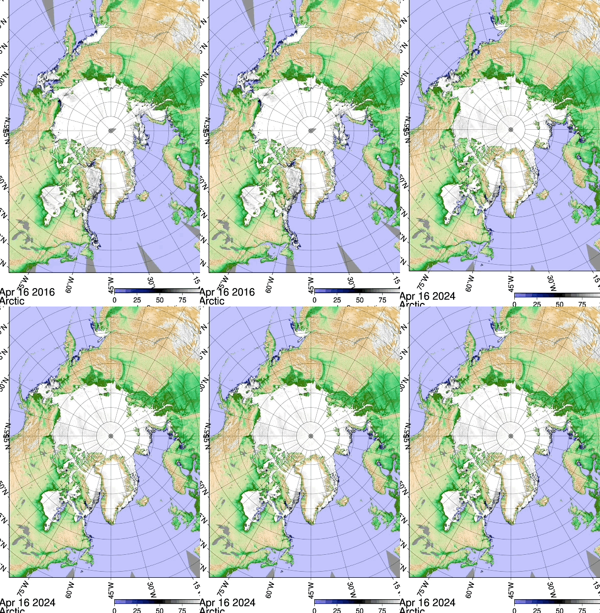
~Comparison 2016-2024 El-Nino to El-Nino
~Less cloud factor spells potential doom with current Arctic Sea ice thinned state
There is always less clouds on the East continental coasts when (West to East) air skims over long distance land as opposed to sea. On the East coasts of Asia and America 2024 JAXA sea ice is almost vanished, while comparing sea ice extent between El-Nino winters 2024 Vs 2016 which was the last major El-Nino year. We have here clear example of current state of sea ice, it is overall thinner, therefore melts easier with more sun (less clouds). This means that 2024 sea ice melt will be remarkably vulnerable from more sunshine. Unfortunately it seems the worse case scenario for sea ice is unfolding, years of thinning ever so slowly, in a precarious state, it might be facing a La-Nina late summer and fall, over all fewer clouds, because of the cloud seeding effect (a theory of mine), during El-Nino there is more clouds world wide, therefore a warmer winter. When morphing to a La-Nina summer, it makes for a super hot summer, because winter didn't freeze the world as much as it could, and there will be less albedo sun ray reflecting clouds. Hence guaranteeing a very low sea ice extent Minima come September 2024.
We note: Siberia had the colder spring and most so during winter, henceforth sea ice footprint is made.
North American Polar ice is set to take a further appearance of melting, but it really is because it never accreted as much as normal (like 2012). Note the Californian coast of 2024 having more an onslaught of the jet stream, hence more moisture, hopefully smothering wildfires for a while to come. WD April 19, 2024


No comments:
Post a Comment