Saturday, November 26, 2016

Late one sided winter start, example of what thick sea ice did regularly months earlier, and what happens later when less sea ice is looser pack

We follow here the progression or regression of the first dominant Anticyclone to cover the Arctic Ocean.  In the Past , Siberian cold continental air easily invaded  and teamed up with the other side 
of the world cold dark clear air massive buildups,  the beginning of cold dark winter didn't take long to be felt by millions once they merged.  Now we see first hand the further demise of  early winter:

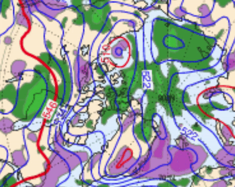
 CMC Surface analysis November 25 18:00 UTC,  November 26 00, 06 and 1200.   With real cold air in Siberia, normal -45 C, but warmer every where else in the Arctic.  Some North Atlantic Cyclones now repulsed towards and warming the Urals, this was the settled view for years starting in October.    We now have a push block situation,  the Pacific Cyclone is pushing Northwards,  the latest North Atlantic Cyclone blocked and stalling towards Greenland.
For weeks,  there was no wide spanning Highs over the Arctic Ocean.  Now we can surmise the numerous leads amongst thinner sea ice finally freezing.  I watch carefully how strong or enforced this North Pole High will be.  The cold gathered in Siberian darkness wages the spread of winter from darker lands favoring radiation to space.  In Northern Canada,  the Pacific and Atlantic Cyclones continue the warmth initiated by the great sea ice dispersion event of early September just past. WD November 26,2016

   Next day November 27  show a retreat of the High whence it came,  back positioning because Cyclones have influenced the jet stream favoring their return to the Arctic Ocean,  made easier by the warmth still present,  the jet stream is bent along the Eastern Greenlandic line easing the return of North Atlantic Cyclones.WD November 28,2016

   November 28 key Cyclone position Northeast Greenland is a slingshot for the next one to the South, North Pacific Cyclone conspires to do the same,  the Siberian High is much thinned but still resisting the perimeter assault.WD November 29 2016

November 29 Push and Pull is in,   the Cyclone NW of Canadian Archipelago coast has severely weakened the Siberian High,  all while partner from the North Atlantic did the same.    Not really apparent,  the High pressure SE of Greenland has injected tremendous heat Northwards abetting
the push to destroy the Siberian Antiyclone.  Again the Cyclones have hanged about Arctic Ocean locations which warmed the most over summer past.  Coup de grace is about to finish the Siberian cold,  the NW archipelago Low will pull in the Atlantic Low ,  soon the entire Arctic Ocean will be back to clouds and Low pressure warmth.  WDNov30,2016

  Gone, the once proud High pressure zone spanning the entirety of the Arctic Ocean vanished Day November 30.  Ever present Arctic heat has encouraged warm air Advection not only from the seas,  but from Northern Canada.   This is quite unusual,  even 2012 had no such event in Early December darkness.   The temperatures of the entire Troposphere in 2012-13-14 -15 spanned much colder all over the long night.  Americans and Canadians don't know yet how warm this winter is setting up to be.  But they already have had a very warm start of winter,  no sign of industrial planetary sized cold air production even in Eurasia.  Every location is geo-meteorologically linked.  Here again suggests warmest influence from the oceans.  WD December1,2016

Thursday, November 24, 2016

Unprecedented Arctic Ocean surface Air warming and computer modeling, are they integrating the sea ice current morphology?

First the unprecedented warming bit.   Autumn early winter 2016 outclasses all others.  DMI North of 80 surface temperature s easily beat 1998, 2007 and 2012 by very wide margins.


We should apparently use this model to predict the next season minima with 66% confidence:

Fall 2011 DMI really didn't give a hint of the coming 2012 summer season melt. 2006 fared quite well,  2015 not so bad.   


ECMWF 500mb animation,  next 7 days along with 2 other models,  GFS and CMC ,  all agree that the incoming Cyclones from the North Atlantic will not happen.  Note the lack of steady position of the 500 mb Lowest thickness.   500 mb  is used here to find the coldest column of air about .    If the 500 mb lowest height was around Southern Greenland,  there would be great flow Northwards.  


CMC surface analysis November 24 1800 UTC,  Culmination of a High mainly built from the Southern Siberia which had -40 C a couple of days ago.    The battle is on,  will the incursion of Cyclones to Pole stopped?  The temperatures at such places as Franz Josef and Spitsbergen are very invitingly warm.  Sea water temperatures of the North Atlantic  are still very High,  over the sea ice,  clouds but clouds despite the 1033 mb High.  Let's see if the great dispersion of sea ice, at  minima 2016,  has finally its impact faded to more normal icescape weather.  WD November 24,2016

Monday, November 21, 2016

Arctic Ocean air in total darkness enormous warmth, even in clear skies with partial North Atlantic air advection.

~Only one thing does that: ocean heat.


CMC Nov 21,  1800 UTC,  Surface Analysis.  Total darkness, varied in location -4 C to -20 C Arctic Ocean temperatures are extremely warm as a whole.  In particular Buoy 48276 ,  -12 C 85 N 90 W,  a place where -30 C is common at this time of the year.    What we see there is a great number of leads, where once was the densest thickest sea ice,  the engine that spurred winter to roar is now mainly  cooled from the South,  the only advection there is cold from land.    The 1024 mb High is not conducive to warming in darkness as well.  The only thing left is the warming from thinner sea ice and these leads,  which under clouds, or making clouds, keep the surface air on top of sea ice warm.

 NOAA HRPT November 21 1500-2200 UTC IR animation.     The warmest air as seen on surface analysis was below denser clouds,  but the open air has absolutely no other heat source but from the Ocean.

          2016 November great Arctic Ocean anomaly is a "dry run" of what an open long night Arctic Ocean would look like.  Cooling in Darkness would take place over Canadian Islands and Greenland,  this bends the Jet Stream Northwards on the East side of Greenland,  effectively driving warm air Cyclones to the North Pole.     In today's current situation,  multiple leads amongst thinner sea ice don't freeze over as rapidly compared with vast extent of older much thicker ice causing deeper quicker freezing and the build up of Anticyclones.  The current flow from the North Atlantic  slows the onset of a normal winter considerably.   The new presence of multiple leads dispersed throughout the Arctic Ocean,  as opposed to in parts as during previous recent warm years,  is similar to a wide open Arctic Ocean,  much tamer now,  but driving the circulation to keep the leads open,  or in the future, to maintain sea water wide open.  WD November 21, 2016