Sunday, October 6, 2013

CLOUDS major play; explains a cool 2013 Arctic summer and warm Arctic fall.

~ENSO split NORTH SOUTH  bipolar personality, south Atlantic hurricane killer

~Global Warming may not be explained in simple terms, one must study to reveal never ending natural variations,  where they may be and why they exist.

     As written below,   the cool Canadian Arctic summer was a complex contribution by 2 major atmospheric players, anti beaufort gyre contrarian winds caused by near persistent presence of cyclones over the Arctic Ocean,  and extensive cloud coverage,  of which were even present over rather large Arctic High Pressure systems which did happen more often lately.

  The great Arctic cloud coverage of 2013 must come from extraordinary reasons,  the -extra-   is of course ENSO but there was an 'ordinary';  the North Atlantic and Pacific, look carefully at the last 4 months,  El-Nino loomed like North of the equator,  La-Nina was just South:

Virtually the same SST image every day for 4 months.  Thanks NOAA...


  One reason why there were fewer or no hurricanes in the South Atlantic,  but lots of thyphoons in the Pacific was and is that the Northern Hemisphere is in El-Nino mode.  While the Southern Pacific is very much like a La-Nina.  ENSO has a split personality syndrome.  Furthermore the North Pacific is unusually warm.  The cloud seeds are planting continuously,  therefore clouds under a high pressure regions are possible.


Conversely a cool Arctic summer,  can't contribute to a cool following fall, not logical isn't it?  However, the clouds persist.  Giving naturally a much warmer fall:

   DMI nice North of 80  Graph says it all.  The clouds are keeping the Arctic fall warmer.  wd October 6,2013

Friday, May 10, 2013

SEA ICE phase changes mimicked by the vertically shifting horizon

~Seeing the thermal effects helps explain the sea ice melt
~ A series of May 2013 days remove the veil from thermal variance mysteries


    In order to establish a 12 melt hour period and prove it, one must record data.  Last few days of photo chemical ice crystals showers slowed the melting period,  for now it lasts about 10 hours a day.  The image sequence below shows a relatively complex drop of the morning horizon as the sun elevation rises.  One may observe the 3 underside phases, freezing (extreme left)  until  steady state 4th from left,  and melting (extreme right).    Underside melting will go on until long wave outgoing radiation become weaker and the ice horizon will rise again in about 10 hours.

    {take sequence to desktop and zoom}   All pictures from land to sea with fixed mount camera.  

Mean time from extreme right melting picture the horizon will drop further and further.


  The total thermal effect from top of sea water column twinned with more intense sun rays on top of ice obliterate atmospheric boundary layers (inversions) created during the night right above the ice.   This shifts the horizon to go lower. During the night, in this case from the much lower midnight sun,  the underside freezes because the net thermal balance favors it, this causes the horizon to rise greatly.    When the sun rises further in elevation ,  sun rays penetrate a thinner and thinner atmosphere, the rays have been less depleted and hit the ice.   The albedo effect theoretically should deflect most of this energy upwards.   But sea ice,  even covered with snow seems to absorb a significant amount of rays, sufficient to change its net thermal balance within 1 hour as seen here,  making it emit more long wave radiation along with short wave deflections (which does not warm air  as much).   We literally see here sea ice thermal emissivity change to the point when the ice 
can't possibly be freezing or accreting.   The underside of the ice is most bombarded with long wave radiation from above and below, thus it melts.


First 12 hour underside melt observed


History in the making:


Same May 10 2013  day, 11 hours later (extreme right picture)  underside ice was still melting.  The day got cloudier a few hours after the beginning of the underside melting.
The clouds were mostly broken stratocumulus at 3000 feet ,  which reduced the impact from photochemical ice crystals (less sun,  less photochemistry).    This reduced sun ray obstructions to surface.   Here seems to be another discovery,  total clear air makes the sea ice more thermally active,  clouds mixed with sunlight reduced wild thermal fluctuations especially in the evening.
This kind of weather is possibly an ideal cold weather sea ice melt accelerator.   At any rate,  after 11 hours of underside melting, the weather was such that I lost the clear horizon, distant snow showers reduced visibility.  However secondary observation spot showed a continuance of the lower horizon.   So for the first time in history, 12 hours of underside melting was observed and nearly completely filmed.   This means that the sea ice at 75 N 95 W is thinning, cracking and vanishing.  Slowly for now, but much faster in no time.  2012 during same May period had consistently smaller melt periods.  The underside ice column also has a significant layer of bottom "soft ice" confirming the visual observations.

wd May10, 2013


Overnight clear sky cooling slows the melt

Clear weather is a double edge sword when it comes to thawing underside sea ice,  this morning (May 12) I measured a later start of melting phase by 46 minutes than from May 10 (above).
Below is a darkened on purpose 1 hour phase change sequence:


The net effect of clear night air was to cool sea ice a great deal more especially with the low midnight sun.  This caused a later freezing to melting phase change,  remains to be seen whether a clear day can counter balance this shift and make the melting period last just as long than previous days.  Clouds with sunshine seem to be the most potent thawing combination.

8 and a half hours later,   apparent underside thawing stopped ,  3.5 hours earlier than previous days,  in cool very clear air.  This is very interesting.  The likely reason is the latent cooling from the clear  night prior,  freezing the soft ice column further than usual.  There was cooler ice to start from, ultimately it was not warmed to previous days balance.  If left to clear air only, the freezing process would last longer in the spring because of the low midnight sun.  Pictures will be placed  up tomorrow.

Clear Sky conundrum, the ice freezes more
~With confirmation of melting phase.


The next few clear days from May 12 were strange and exhilarating.  Turns out that clear skies were indeed not conducive for melting sea ice,  even with the midnight sun
at reasonable elevations.  From May 10 and 11 melting periods of 12 hours or more, day 12 went to 8.5, 13 8 and day 14 even less long.  Despite 24 hours sunshine
and on day 14 warmer temperatures.

First on day 13, I have confirmed a melting phase.  If sea ice is one solid block of uniform ice and for example there is no melting going on when there is more sun rays hitting it, the horizon should drop continuously,  without interruption similar to what it does at night,  raises continuously in direct relation with the lowering elevation of the sun.   Inversions are such that there is no limit to the horizon rise,  if there is less and less rays the surface to air interface inversion becomes stronger and stronger.  Causing a form of looming,  the sea ice well frozen looses most of its energy to space,  since the ice is at same thickness the only variable is the long wave radiation escaping to space.  Theoretically with the one block of ice getting warmer as the sun rises, at local apparent noon,  when the sun is at daily zenith,   the horizon should be lowest,  it was not observed as doing so.   The horizon reaches a steady point and stays there,  similar to boiling water, when the temperature reaches 100 C it stays there until all water evaporates.  Likewise with sea ice,  the underside melts,   a new thermal balance is reached where the horizon stays at constant elevation.  What likely happens was triggered by the changing nature of the sea ice column when water melts on its underside the ice column is not the same.   Its a mix where sea water is part of the process, at that moment there is  a much larger body of  matter to exchange heat with.   Unlike 1.7 meters sea ice, this sea water may be considered as having infinite thermal capacity,  therefore there is a lull in the lowering of the horizon.  Its the same as air interfacing with open water ,  a thermal exchange causes a fixed horizon level, only to be changed when especially the air temperature just above varies.  A similar effect occurs when the sea temperature becomes different.  But as seen below,  especially places like Redondo beach California,  a small difference between sea and surface air temperature doesn't shift the horizon a whole lot.     Sea ice is unlike the sea surface because it is insulated and may be considered a body separate from the sea until it starts melting in the underside.


Bottoming out of dropping horizon:
The first picture from left until 4th spans nearly 3 hours at about the same horizon height, 
despite the pre and post local apparent noon sun.   Very similar to sea to air horizon when the sun can't heat the sea significantly enough to make a shift.  The furtherest picture right was equally fascinating, this phase change occurred significantly earlier than previous days, 1 hour earlier,  despite clear blue sky compared to cloudy weather.

   Although this sequence just above (repeated twice more),  represents a better understanding of what is going on under the ice surface,  the last one furtherest right was puzzling.  Why would there be more freezing on a sunny clear day?  The next 3 days were clear,  it seems the ice was made warmer by clouds,  then sea ice cooled dramatically at first clear night,   slower on the next following days.
The freezing period was progressively longer,  with subsequent clear nights and days of May 13 and 14.  Even though the temperatures were 5 degrees warmer on the 14th.
From 12 hours of melting in clouds,  the freezing became stronger  in each subsequent clear air day because there was an adiabatic process which evolved from weaker to stronger,  since the air above was relatively still cold,  the adiabatic process on the 14th was equally more unstable.  In the fall,  particularly over wide open Arctic water,  adiabatic air profiles favors surface cooling.   Only the higher 24 hour sun can compensate for the heat loss from adiabatic process,  likely as records show end of May at 75 N.  When clear air will likely give melting longer than 12 hours.   The other discovery here is equally important,  partially cloudy weather has been the greatest factor increasing melt times, so far....WD May 15, 2013


Returning clouds stops sea ice night cooling
Subsequent clear nights of May 12,13 and 14 amazingly slowed the melting process until the 14th when there appears to be a gain in late melt time from Local Apparent Noon.
May 15 late AM. at first it was cirrus,   approaching from the southwest,
then lower clouds from a small cyclonic system.  The results were interesting,
the high clouds gave similar horizons than with clear skies, at first,  then the horizon never bottomed out for long afterwards (line in yellow).  In the evening,  the usual sudden rise of horizon from long wave radiation loss to space slowed a great deal compared to preceding day, so this means a lesser extent of cooling. Resuming the longer  melting period especially for tomorrow, since the night is cloudy.  I'd expect an extensive melt period nearing 12 hours if there is partial skies again.   We shall see...WDMay 15, 2013

Low clouds exceed 12 hours melting again.


Night of 15-16 was cloudy ,  day 16 equally so.  Fortunately late evening gave ideal conditions to study,  mostly cloudy but with a clear  horizon.  Instead of the usual rebound with clear or high cirrus,  the horizon  remained low indicating a likely 12 hour melt day.    Again broken clouds peppered with sun breaks gave the maximum thawing effect.  This great method of observing the Thermal balance of sea ice shows an elegance in heat exchanges.   A continuity,  a follow up from the consequence of the previous day and night.  Clear days cool the ice more than warm it,  until the midnight sun becomes higher in the sky.  Cloudy days prop up the thermal influence from sea heat, bouncing back from cloud bottoms instead of escaping to space.  The clouds reflect back the heat from the sea ,  which as the graphs above show,  does not bottom the horizon elevation as much as the sun during a clear blue day.  But overcast conditions are lethal for sea ice growth,  something
most specialists always knew,  but not for the fact that clear skies- not at the North Pole -  give a strong diurnal thermal variation favoring ice accretion. WD May 16,2013


What happens when the sky is mixed 50% blue?  


Same graph as previous day except for purple line representing May 17.A mixed sky shifted the horizon all over the place.  There was at first mainly cirrus which gave practically the same horizon heights as clear skies, bottoming slightly higher than a clear blue day.  Than at evening the clouds, even cirrus moved away,  causing an abrupt change of phase from melting to freezing.  Afterwards the sky dome changed appearance
with a mix of low clouds and cirrus taking turns over the filmed horizon light rays path.
When low clouds dominated the horizon dropped, when cirrus covered the ray path
the horizon rose.   wd May 17, 2013


Horizon BOTTOM elevation confirms a deep water column source of energy

May 18,  measured the horizon at Local Apparent Noon ,  2.43' above a fixed point again, as often as the sun is 30 degrees high and there is no clouds  or just high Cirrus.
It is a wonderful repeated observation confirming the under sea ice is melting.  Sea water temperature can be considered a constant,  only the sea ice and surface air changes in nature.   So today,  a warm sunny day of spring,  has warmer temperatures than preceding days,  by more than 10 degrees C.  Yet the bottom LAN horizon is a constant?
Something is making it so:

The horizon can drop further than 2.43',  this is a 1.73' arc minute September 2010 open water example. It can lower even more.

Consider again the sea ice one single ice sheet,  uniform in density,  1.8 meters thick,
from direct sun rays it's horizon should lower and lower along with the rising towards noon high zenith sun.  In the High Arctic it does so daily.  But then the horizon stops lowering,  remains at near constant elevation only to rise when the sun is about 25 degrees on its diurnal course towards the midnight lower in the sky sun.    If perfectly insulated from sea water, the top of the sea ice should reach a thermal balance similar to the picture ( just above, with 1.73' above fixed point),  but it doesn't.  Something is moderating the course of events.  And that is the sea water thermal signal mixed with the ice thickness which now doesn't appear to change,  for that to happen something must give,  this something has to be melting sea ice.  The energy gained by sun rays twin with heat energy from the sea, merge to melt underside ice keeping the horizon constant.  Water replaces bottom ice, this should make the horizon lower but it doesn't,  because sea water does not change in temperature (just like the ice next to it),  there is a vertical displacement of water just melted.  Being replaced by  constant temperature water from the much thicker water column.  When the sun energy is insufficient to compensate for thermal radiation escaping to space, the ice bottom refreezes,  insulating the ice further, lengthening the insulation from top of sea column to top of sea ice.  This changes the structure of the surface to air interface  immediately above the ice.  wd May 18,2013


New horizon bottom,  the ice melted until the skies cleared

May 14                                        May 20                                May 22
A long series of cloudy days eventually reduced the horizon elevation to about 2.13' above a fixed marker point.  On  May 22 with clear afternoon sunshine,  the low horizon was repeated.  This means that the ice thinned, or the column of soft bottom ice has gotten even thicker.     May 14 had 2.86' horizon, May 20 2.13' and May 22,  after cloud effect,  the horizon , even with high sun all day,  the same horizon was 4.32' all at about the same some position in the sky.  


    On May 22 the same low horizon with a strong sun above 30 degrees elevation,
resumed the horizon with low clouds achieved the day prior.  This new refraction bottom  is likely due to a new state of the the nature of the sea ice,  either thinner or physically altered by  a different softer to hard ice ratio.   Warmer temperatures did not play a major role in this change.    It is the net balance of thermal rays,  namely Long Wave Radiation which created these interesting changes.  WD May 22 , 2013


MIDNIGHT SURGE
May25 3 PM left, later past midnight right,  even with much milder temperatures the solar diurnal effect still takes place, especially with clear skies.  The sun at 6.4 degrees 
at midnight is by far weaker and not capable of melting underside ice.  At this late time there is freezing even at -7 C with about 2 meter sea ice.  Long wave radiation escapes to space, particularly from the top of the sea water column, cooling occurs bottom side gets coldest as opposed to earlier warmest.  There is a couple of interesting effects,  namely 
a 6 degree sun in  February noon gave a much lower horizon.    There is resonance with the sun ray intensities,  if the rays lessen in total photons the horizon rises,  the opposite is true even during much colder weather.    A sun 6 degrees from the South at noon usually has a lower horizon than with a 6 degree midnight sun.  There seems to be a photon momentum effect., but its likely because the ice cools further from a warmer point than from a much colder state of total weighted temperature.   

WD May 26,2013


For a better understanding please read below:

Data gathered from Optical Refraction above sea ice. An introduction


Saturday, April 27, 2013

Significant dropping horizon near the North Pole.

~ A lowering of the horizon with the sun risen by 3.1 degrees
~ Likely what is not seen which causes stronger than expected effect


    Expectations were met with a bit of a surprise,  a visibly thick drop can be observed readily throughout the horizon.  This implicates thin ice.  Thicker ice should have had a slower drop because thicker ice has lost a lot of heat during the long night.   Thinner ice warms up quicker from above and from the warmer water below. The formulation and calculation of how thick the ice is will take time and effort,  but it can be determined by comparing with other locations with known thickness.  ---- Read more about this new scientific method with the next article below.  WDApril 27, 2013

And the falling horizon continues.......

The gap is huge, potentially indicating a great melting is occuring.  A 170 cm horizon should drop about .57 minutes of arc per sun rising degrees.  If the ice is 170 cm
thick the gap should be 2.28 arc minutes wide,  I measure about 2.4' of arc drop making the ice about 2 meters thick.  .   errata,  the scale used was incorrect,   2.4' of arc is not possible to determine with the resolution of this picture.  the gap was closer to 22' of arc suggesting a significant thermal event,  which may have been caused by significantly thinner ice or wide open water.     April 30, 2013  ----May 2 correction May 3


Cam 1   definite signs of melting from the snow top:

     Cam1 has no such great drop of horizon,  that is better,  no ridging means that there are fewer recent leads near by.  It represents the majority of ice surface about the Pole.
The resolution of the NOAA pictures is such that a drop of the horizon can only be seen
when the sun is much further up in elevation.  Higher resolution upgrade of either the camera or photo processing would show a shifting horizon.  But since we have none, implies we must wait until the sun rises a further 5 or 6 degrees before it shows.

    Astounding!  The snow surface is in sublimation mode,  this is what snow looks like when it disappears quickly.     The effect of the sun at 12-16 degrees elevation bombarding sea ice surface demonstrates without a doubt that both ice and air has warmed considerably,   this type of snow is a precursor to water puddles  WD May 4 2013


Despite ridging a small perceptible drop can be seen:

     Its not big, but if you zoom after moving to desktop there is a small likely significant drop especially on top of radiometer.  The resolution of camera shot is such that a precise
measurement is difficult.   The snow nodules got drifted over, and it has been very cloudy and foggy near the pole, this slows the melt progress quite a lot.
WD May 12, 2013

      Significant drop is clearly large

   near North Pole horizon shows up significantly lower when sun is 10 degrees higher.  
There was ridging at right side of radiometers.  But the left side has undeniable lowered horizon, normally I would expect this drop to be about 4' of arc or more,  NOAA picture drop is greater than that.  WD May 25, 2013


Sunday, April 14, 2013

Data gathered from Optical Refraction above sea ice. An introduction

~ Pre paper basics presentation.
~ Ice formation is not strictly the result of colder temperatures

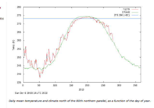
    Unlike  surface water,  sea ice has rapid thermal variation characteristics which enables an instant evaluation of its thickness and age.

  Lets go back in time,  a March 2004 sunset comes to mind:


        Apparent high Arctic sunset disappears in mid air. That was not so.  The sunset was much raised with the ice horizon.  By 11 arc minutes.  The horizon was higher, the entire sun disk transforms in turn.   From ovoid to becoming saucer like,   eventually morphing to a sun line which was highly compressed sun disk image.  Arctic haze,  more common then,  masked the raised ice horizon.  At the time,  sea ice over the NW passage was a mix of old and new.  Multi-year ice made the onset of freeze-up earlier in autumn 2003.  The end result was thicker ice  many months later in March when this sequence was taken.

    Refraction effects can be even more complex.  Horizontal refraction permeated the lower horizon,  seeming to dissect the air
layer by layer,  making the sun's upper limb wearing a green flash  hat,  or at the end revealing gravity waves streaming.

      Fortunately sun disk effects are much more complicated than the rising horizon.   There is so much air thickness  between sun and camera which absolutely demands a greater knowledge of great chunks of the atmosphere.  


       Inspiration to study something apparently simpler came about.     To make sense of all these mirages a steadier subject was needed.   Elevation wise,  sea ice varies throughout the day.   Can be studied at any time for days especially with good visibility.


   From this visual aspect,  using a baseline value for sea horizon height having water and surface air with the same temperature, a retrospect evaluation of sea ice thickness is possible.  On this March 2004 day, there was likely a sea ice mean thickness of 3.2 meters over a huge area of the NW passage.


  1- Instant Identification of sea ice status, freezing, melting or steady state


     Long wave radiation has a way to be revealed,  if a body emits a great deal of it,  the immediate area adjoined will be warmed.   In the case of sea ice,  sun rays heats sea ice surface,  but warming comes from below as well,  Arctic sea surface temperatures are almost always higher than air during winter, this continuously tends to soften the ice bottom making it become brittle or fragile.    If the sun is strong enough,  the sea ice to air interface looses its boundary layer, or  structure.  

Steady state:


     September 2012 Sea surface temperature (devoid of ice)  is equal to the surface air,  the horizon is at steady state,  it appears at pure astronomical horizon elevation.   If the Horizon goes below this level,  there is an inferior mirage,  the water or ice is warmer than the air.  If it rises above, there is an inversion,  when so water or sea ice surface is colder than the air.


Melting;


   March 19, 2013,  seemingly cold -26 C day.   The ice horizon was lower than the steady state,  the ice is not getting bigger at this moment,  more likely melting from the bottom, warm surface sea ice nullifies the inversion above which was keeping the cold air locked,  and creates an inferior mirage,  similar to road mirage.

Freezing;

   Same day but later ,  the sun is 3 degrees above the horizon,  ready to set.   Ever since last picture was taken, the horizon rose in small increments,  will continue to do so.  The steady state astronomical horizon line was exceeded higher, sea ice was thickening.   The cold air overtook the  heat gained by the sun, there is a net heat lost by the ice.  The apparent horizon gain gives away the over all thickness of the sea ice.   As a general rule, the thicker the ice,  the quicker the horizon rise.

2- Determining ice thickness by refraction

     There can be several methods of determining sea ice thickness optically, which means immediately.  During the long sunless  night,   the horizon was highest when radiation escaped to space directly without interference by clouds,  which may affect the radiation balance at sea to air interface.    On a mostly clear evening the ice horizon peaks after sunset:


    From minima day onwards the first onset of thinnest ice,  clear sky horizon rose in tandem with ice thickness.  One basic empirical rule is 50 cm per minute of arc increase.  In this picture above, it means 160 cm overall ice.   255 cm less than compared to 2004 sunset sequence at about the same date.

    Applications:

       Studying instantly whether sea ice is growing adds a better understanding on how accretion works,  in the case of winter 2012- 2013 freezing season,  there was melting as early as March 18, at about sea ice maxima peak.   It was short lived by a few hours,  subsequently melting grew longer day by day,  eventually the melting period of any given day will exceed the freezing once  the horizon is lower than a steady state level more than 12 hours a day.    Freezing is not a continuous process dependent on degree days,  but rather whether the radiation budget of sea ice is in a loss or gain mode.  Remote sensing merely calculates the gain or loss of sea ice volume or extent,  but horizon measuring explains what is happening directly.  The two methods of visualizing sea ice complement each other, and should be utilized in improving sea ice models.  WD April 14, 2013


 High Arctic Earliest melt,  West of Southwest Cornwallis Island


   Spring Equinox Freeze up Maxima of Northern Hemisphere Cryosphere  is not a coincidence.  The returning sun stops accretion and causes the melting of sea ice,  very early on particularly on its bottom.  Surface Sea ice may appear cold, normal  and well set,  but that is not the case on its underside.  It may be very cold outside,  but sun rays on a clear sunny day have a huge impact over lower accretion action.  Above is last 4 seasons spring collage.  2011 was the coldest year sea ice wise.   The first column displays earliest bottom melts.  2012 and 2013 had very low horizons way earlier,  although 2010 data was scarce in February.   Second column displays first extreme low horizons,  all within March 11 and March 19,  sea ice Maxima period.   Third column sets the date when continuous low horizons were seen afterwards.   2011  was particularly good for sea ice preservation.  Late February shots were at sun elevations 5 to 7 degrees during Local Apparent Noon.  Indicating a sun merely 6 degrees high has an impact over the energy balance of ice.    Thus  11.8 to 15 degrees elevation sun causes certain melting on the underside,  while 5 to 7 degrees elevation  noon sun can do likewise but the conditions must be right,  thinner ice and likely less snow insulation may be major factors.  2012 and 2013 were noted as having earliest underside melts,  this is likely because of the disappearance of multi year-ice.    WDApril 21,2013

Practical examples:    

  Current NOAA North Pole Cam :


          Using fix point reference the radiometer box,
     The horizon height should vary,  all be it not very high as with examples above. The data acquired from this variation will show the nature and status of the ice.   The sun rises very slowly continuously, until it rises a couple of degrees,  only clouds will affect the horizon,  unless one uses very high resolution programs converting the image,  if capable a slow and gradual reduction of sea ice horizon will occur .  wd April 20, 2013
   A very small drop in horizon has been detected after 5 days.  This suggests thin ice melting on its underside.   April 21 2013


Lets go Surfing

  This method applies for any horizon,  including Redondo beach L.A.

  Redondo beach L.A.   extreme right picture displays a significant drop in horizon at about 1 PM,  the effects are very similar to sea ice.  The sea surface  has warmed due to warm air and High noon sun.   The surf looks good from likely sea breeze keeping shore weather cooler.  wd  april 20
Night time and morning have extreme variations, not as much as sea ice,  but noticeable if you take sequence to desktop and zoom.  April 21,2013
Really obvious drop at right april 24.

At this beach there is an evening diurnal rise very similar to sea ice,  day time horizon drops and night time and very early morning rises.  bring to desktop and zoom on image.  April 25 2013

    Unusual,   with sea surface 16C with surface air 16 C.  Could be a fog bank on the right picture or the true astronomical horizon.   Must observe further.

    Observe the significant drop at right, which only means warmer water than air.  May17,2013

May 6, 2013:
   Redondo beach May 13 near perfect astronomical horizon at extreme right.   May 13, 2013

What about Scotland?
Yes variations on Fraserburgh Aberdeenshire webcam show the same drop.  But slower,
and at evening end.  WD May 1,2013

Scotland never disappoints look carefully:


    Warm from land winds have created a great looming or superior mirage seen at far right.    Sea water at this time is +6.5 C air going to Northeast at 21 km/hr.    The temperature difference is such that the horizon rises above an apparent air layer.  wd0505

Fraserburgh astronomical horizon.  
   The theoretical perfect astronomical horizon,  temperatures of sea surface and air is equal.  So far, most of Fraserburgh horizon was high because the water was colder than the air, but here a stint of cold air lowered the horizon substantially.  For it to be even lower will likely require winter weather when the sea becomes warmer than the air the horizon will lower further.  Note the lower light house pier seems aligned with the perfect astronomical horizon,  an accident?  Or an architectural master ly design.   WD may9,2013

   Fraserburgh June 8 sea temperature colder than the air (right) ,  the horizon goes higher  than picture above .  WD June 8 2013