~Interesting article by GSC Gavin Schmidt, a must read: https://www.nytimes.com/2024/11/13/opinion/climate-change-heat-planet.html
~Most can be indirectly understood if you read my latest of many similar yearly April climate Projections for the summer fall:
https://eh2r.blogspot.com/2024/04/2024-summer-fall-projection-forecast.html
The reason why the warming is greater for the Northern Hemisphere is simple, Arctic sea ice reduction in area and thickness surrounded by continents. For this we must look at NASA GISS:
                  Annual mean Land-Ocean Temperature Index in 0.01 degrees Celsius
                                      selected zonal means
                                      --------------------
                    sources:  GHCN-v4 1880-10/2024 + SST: ERSST v5 1880-10/2024
                    using elimination of outliers and homogeneity adjustment
Note: ***** = missing - base period: 1951-1980
24N 24S 90S 64N 44N 24N EQU 24S 44S 64S 90S
Year Glob NHem SHem -90N -24N -24S -90N -64N -44N -24N -EQU -24S -44S -64S Year
2021 85 114 55 143 65 53 206 136 127 72 58 72 33 30 2021
2022 89 116 62 152 56 70 235 150 127 62 51 78 40 108 2022
2023 117 150 85 178 106 71 258 187 147 108 105 90 45 62 2023
Year Glob NHem SHem 24N 24S 90S 64N 44N 24N EQU 24S 44S 64S 90S Year
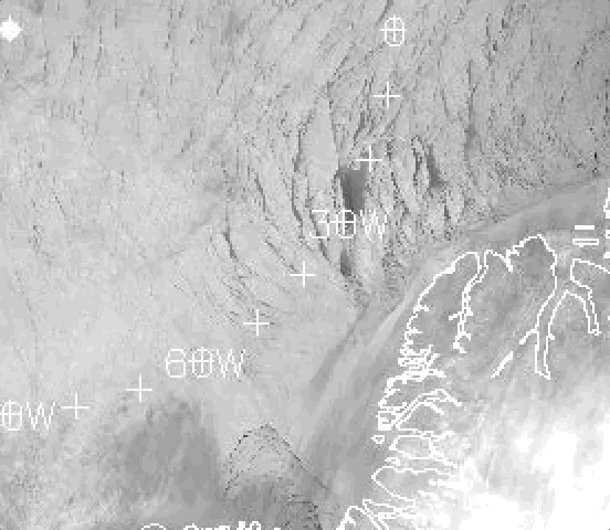
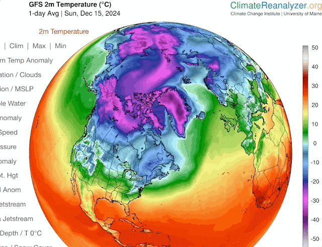
-90N -24N -24S -90N -64N -44N -24N -EQU -24S -44S -64S The zonal mean 64-90 North and South says it all. There is a continent wide Glacier at the South Pole, while at the North Pole there is a continent size Ocean covered by sea ice. If this sea ice vanishes, something likely to happen during a coming summer, temperatures at North Pole Region would warm much more. At the moment, the warming is gradual but close to 4 times faster compared to the Antarctic.
A slowing of global circulation is a symptom of massive temperature differentiation from one temperature zone to the next, as the Arctic sea ice disappears so will the Northern Hemisphere swift weather events usually lasting a day or so, temperatures between the North Pole and Equator will be significantly less, engendering slow to sluggish circulations causing catastrophic events to linger, such as Typhoon/Hurricanes moving slowly over a populated area, as already happened. Causing entire regions languishing under same weather conditions for days or much longer, such as excessive droughts, never ending heavy rain periods as has happening more recently again.
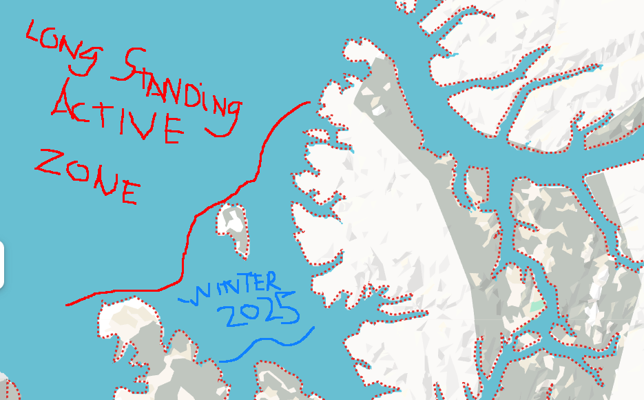
July peak record breaking temperatures way above climate model projections (NYtimes article) is an indication confirming that Northern Hemisphere is warming faster than the South, largely tempered by massive Oceans and said huge Antarctic Glacier. There is ample evidence of Arctic sea ice changes, suffices to say, its state is nowhere similar compared with a mere 20 years ago. Especially autumn and winter ice topography, recently more broken and with open water, along with the warmed Oceans have caused our present delay of onset of winter worldwide. WD December 1 2024