 |
| For the record, Venus-set January 14 2017, South of Cornwallis Island Nunavut Canada. Top of a hill 2 degrees elevation high from the altitude of the camera, the brighter colorful picture shows 2 important features, one is dispersion of colors according to refraction laws, red is refracted less than other optical wavelengths, green much more. The second yellow-red picture occurred just before Venus-set, the colors are truer, there is less overexposure. The 3rd in faint blue is a Venus blue flash, when the planet light beam is behind the top of the hill, the upper most smallest segment of blue, the color refracted most, was carried last bent foremost in a narrow air duct. Compared to same location top of same hill previous sunsets, 4 Venus-sets happened with the least refraction. This was caused by a warmer hill top reducing the inversion lapse rate, despite very cold air temperatures, the coldest of winter so far, which arrived about a day and a half before. The hill was warmed substantially by the lack of wide open clear air, following incredible persistent cloud coverage. When this sequence was taken, mainly clear air lasted for a few days. WD January 25, 2017 |
Wednesday, January 25, 2017
Blue Venus oracles.
~Amazing sequence reveals strong warming after 2 months of 2017 long night.
Thursday, January 19, 2017
Arctic Atmosphere is not the only thing with higher temperatures
~Latest state of art refraction work demonstrates land and sea ice abnormally warmer.
 January18,2016. Sea ice horizon in darkness, a perfect way to study radiation fluxes. 2015-16 was a warm winter, it had thinner sea ice, but more snow , 40 cm, a proxy for sea ice making it thinner. warmth and snow made sea ice more than 30 cm below sea average.
To make out the meaning of the latest results we must study the over all circulation picture courtesy NCEP/NCAR , the following are model maps of 600 mb temperatures, at about this altitude we can determine the temperature of the entire troposphere which varies from one geographic point to another. I find these maps helpful, but we must keep in mind that there are no upper stations over the Arctic Ocean.
 Thinner sea ice circulations: We remember 2013 melt season; like one large Cyclone throughout the summer. 2016-17 long night circulation was Longitude 90 Degrees-North Pole- Longitude 90 degrees Russian side extending longitudinally Eastwards , an "L" shape . Mean Vortices of the Polar vortex locations of 2013 were split in 3, The winds rotate counterclockwise around the coldest air, the Blue zones. This 2013 circulation pattern favored a much colder Eurasia, mildly colder western North America. In 2016-17, the vortices have migrated Southwards, a reflection of thinner sea ice during winter, the average here for North American sector does not represent this well for this sector. With this Polar Vortex pattern, NW Europe has a larger input of Cyclones from the Atlantic, more snow for the Northern Eurasian region, unlike last winter these Lows tended to crash towards Novaya Zemlya which made for greater precipitation in that quadrant. A strong vortex (not seen here) hovering about the Canadian Archipelago, in particular West Greenland Disko Island, helped pull Cyclones towards the Pole. As a result, 2016-17 circulation for the Canadian Archipelago has had far less snow than last year. The snow maps indicate a great layering from Pacific moisture East of the Siberian Vortex, the coldest of the season so far.
 The average Low Pressure footprint from the North Atlantic 2016-2017 dark season so far. The zones with Higher pressure were over the continents where the greater cooling took place.

Last season 2015-2016 had lower pressure average North of Ellesmere. North Atlantic Cyclones died there, now they are attracted or steered by the greatest of the Polar vortex vortices, the Siberian one. But the Arctic Ocean laced with water, much thinner ice, "attracts" Low pressure systems just as much as last winter. Some linger and die over the Pole, while they do, the clouds outright warm everything to huge anomalous temperature gains. From greater open water/thinner sea ice heat flux the Lows die slower, while they do, they "invite" other Northward Lows to replace them, because the shaping of the jet stream is to the North mainly over the Gulf Stream, a huge steady source of moisture. The smaller vortex of the the Polar Vortex vortices, was mainly centered over Baffin Bay, although migrated North or South from that location. This heavily shaped the North Atlantic Jet Stream to bend Northwards.
Warming of the entire Arctic recorded by optical method:
The continuous onslaught of Cyclones Northwards along with the much more open sea water and thinner sea ice had a huge unprecedented effect on the atmosphere, land and frozen or open seas:

January 19 2017, it has been seasonably colder -33 C for about 4 days with a peak dip nearing -40 C, a departure from overall much warmer winter. The sea ice horizon from November 2 past, rose 3.5' of arc, a significant drop in height during total darkness compared to last year. A lowered horizon is always characterized by a lesser temperature contrast at the surface to air interface, this latest observation is a strong indication of more heat on the surface which warmed cold clear air more than last year. The best way to explain this is 2 blocks of equal volume of identical matter, one at higher temperature, the other at air temperature, the immediate impact of the warmer block would be to raise the temperature of the air next to it. Likewise, after months of mostly cloudier High Arctic weather, effectively reducing thermal radiation escaping to space, along with greater heat injected by open water and thinner sea ice, the land and sea ice has a net warmer presence, this translates in a lesser temperature contrast reducing horizon heights.
Just at the clearing of clouds, a few days prior, the data was even more compelling:
 January 14, 2017, a day after the persistent clouds cleared, it was -37.1 C, a near 20 C drop in temperature occurred, at this point, the horizon was 1.84 arc minutes above the November 2 2016 just freshly made new sea ice. This basically demonstrated the long night cooling slowed substantially, late in dark season ground surfaces offered a lot of residual heat reducing interface cooling. The net refraction difference in altitude gain was a very significant -3.41 arc minutes between 2016 and 2017. This is without interference from winds , clouds and with similar seasonal colder temperatures. To confirm this pervasive warming, a few hours later, planet Venus set over a hill:
 A Venus blue flash indicated its last moment before disappearing below a 200 meter Above Sea Level hill 3.5 km distant from the telescope. This hill is largely made of gravel on top of a interglacial rebounding limestone from the Paleozoic era. The blue flash contrasts well with similar blue flashes ending of sunsets at the same location which occurred in the past late February's. The hill sunsets altitudes were averaged compared to 4 Venus sets in total from January 10, 11, 12 and 14 2017. The Venus sets disappeared at a higher altitude than sunset upper limbs by 1 to 2 arc minutes. A staggering difference! Especially at 2 degrees altitude, the top of the hill was demonstrably warmer than the sea ice. Even more impressive, the Venus sets were from a continuous total 2 month long darkness, proved the current hill top surface to air interface lapse rate weaker than with sea ice, no small event given the elevation height which naturally reduces refraction variances....
South of Cornwallis land , air, ocean and sea ice, all where measured warmer than usual, the exact impact of such geophysics so late in the long night can only make the coming weather days predictively warmer. WD January 20, 2017

To make out the meaning of the latest results we must study the over all circulation picture courtesy NCEP/NCAR , the following are model maps of 600 mb temperatures, at about this altitude we can determine the temperature of the entire troposphere which varies from one geographic point to another. I find these maps helpful, but we must keep in mind that there are no upper stations over the Arctic Ocean.
 |
| Super melt years, circulation axis of the long nights 2006-2007, 2011-2012 and 2015-2016 had one thing in common; they were SouthEast-North Pole-SouthEast Russian side, the transpolar Southeast Axis. The Polar Vortex morphology was shaped favoring a very warm NW Europe and North America. And it was. |


Last season 2015-2016 had lower pressure average North of Ellesmere. North Atlantic Cyclones died there, now they are attracted or steered by the greatest of the Polar vortex vortices, the Siberian one. But the Arctic Ocean laced with water, much thinner ice, "attracts" Low pressure systems just as much as last winter. Some linger and die over the Pole, while they do, the clouds outright warm everything to huge anomalous temperature gains. From greater open water/thinner sea ice heat flux the Lows die slower, while they do, they "invite" other Northward Lows to replace them, because the shaping of the jet stream is to the North mainly over the Gulf Stream, a huge steady source of moisture. The smaller vortex of the the Polar Vortex vortices, was mainly centered over Baffin Bay, although migrated North or South from that location. This heavily shaped the North Atlantic Jet Stream to bend Northwards.
Warming of the entire Arctic recorded by optical method:
The continuous onslaught of Cyclones Northwards along with the much more open sea water and thinner sea ice had a huge unprecedented effect on the atmosphere, land and frozen or open seas:
 |
| November 2 2016, the sun has about vanished, no more solar warming, new sea ice just formed, late once again, cools the atmosphere further by insulating the ocean. This caused the horizon to rise, since the lower atmospheric air is still warm, but the sea ice to air interface, very colder. |
 |
| We look back 2016, January 23, with -36.1 C surface temperature, in darkness and even if this was colder, during a remarkably warmer winter, interspersed by cooling and at least 5 important "heat wave" periods. There was a lot of snow, twice the usual normal. Despite all this, the horizon rose 5.25 arc minutes higher than to November 2, 2016. Still in total darkness, the sun didn't rise for another 2 weeks. |

January 19 2017, it has been seasonably colder -33 C for about 4 days with a peak dip nearing -40 C, a departure from overall much warmer winter. The sea ice horizon from November 2 past, rose 3.5' of arc, a significant drop in height during total darkness compared to last year. A lowered horizon is always characterized by a lesser temperature contrast at the surface to air interface, this latest observation is a strong indication of more heat on the surface which warmed cold clear air more than last year. The best way to explain this is 2 blocks of equal volume of identical matter, one at higher temperature, the other at air temperature, the immediate impact of the warmer block would be to raise the temperature of the air next to it. Likewise, after months of mostly cloudier High Arctic weather, effectively reducing thermal radiation escaping to space, along with greater heat injected by open water and thinner sea ice, the land and sea ice has a net warmer presence, this translates in a lesser temperature contrast reducing horizon heights.
Just at the clearing of clouds, a few days prior, the data was even more compelling:


South of Cornwallis land , air, ocean and sea ice, all where measured warmer than usual, the exact impact of such geophysics so late in the long night can only make the coming weather days predictively warmer. WD January 20, 2017
Friday, December 23, 2016
Thinner sea ice adds a whole lot of heat to the dark Arctic Ocean lower atmosphere, changing its circulation.
A paper published in 1996 by Steffen and DeMaria:
after measuring Heat fluxes over Barrow Strait Nunavut Canada within sea ice and upwards in 1980, this paper basically demonstrates how much energy can be unleashed if the sea ice becomes thinner, in effect about 4 times more heat is dissipated to the atmosphere if sea ice is 32 cm instead of 1.1 meters thick.

It is the mark of thin Ice to give off more sensible heat. By conduction and convection at the surface to air interface. Thus it was November 1980 just South of Cornwallis Island. Refraction wise, this is seen by a lower horizon. An impressive mean of 129 W/m2 dissipates upwards.

Radiative heat flux takes over as the main dissipation thermal system as sea ice became thicker, now some 1.1 meters, 3 months worth of pre 1998 normal cold during the long night of 1980-81. Insulation from accretion makes it so. But only 36 W/m2 towards space, drastically less than 3 months earlier. All the data from this paper mainly was but in pure darkness with very low negligible sunlight in February and November.
When the lower Arctic troposphere warms, the entire Upper air profile changes. So is the natural way of Atmospheric Physics:
Average Monthly Upper Air Maxima altitude in meters 2011-2015
Southwest Barrow Island.
Southwest Barrow Island.
 |
| The height of Upper Air Profile Maxima increases during winter, reaches a peak by February, then becomes gradually lower towards the long day until vanishing during summer. As the Maxima lowers in altitude , the surface to air interface upper air lapse rate does the same, it lowers in stability: |
North Barrow Strait, Southwest Cornwallis Island 2011-2015 average surface to air interface Lapse rates per month, excluding June July August, in degrees C per100 meters
 |
A February +5.4 C/100 meter lapse rate is super stable as opposed to -1 C/100 meters in early summer which is the normal adiabatic lapse rate of the standard atmosphere: 10 C/km. Very latest data suggests a leaning towards adiabatic lower temperature profile, opposite to winter building up. A higher temperature profile maxima altitude makes for a steeper surface based inversion because the atmospheric heat source is more distant from the surface. Steeper inversions cause greater refraction effects which have been extremely rare compared to the same dark season periods going back as recently as the last 2 years. This suggests enormous current heat injections. Arctic summer natural effects from no sea ice gives the turning of the extreme lower troposphere temperature profile from inversions to adiabatic. In the graph above, adiabatic lapse rates predominate between May and September, during these high in the sky sun days, air temperatures decrease with height from just off the ground. For other months; January to April, October to December the lapse rates are positive, because just above the ground air warms with height instead, until becoming adiabatic again till the tropopause, at the altitude where inversion turns adiabatic is the temperature profile maximum. Surface based Arctic inversions dominate throughout Arctic late Autumn , Winter, till late Spring. It is a sign of winter, when frozen ground and sea ice in darkness radiate heat upwards with air, thermal radiation eventually escapes to space during cloud free nights, the Arctic having one long night in particular, these inversions are nearly absolutely permanent for 9 months of the year. But lately these common inversions have been reversed to adiabatic profiles, in deep mid winter darkness, the amount of heat energy needed requires warmth from the sea. The impact of less mid-winter sea ice thus cancels the inversion nature of the lower atmosphere. Once nullified, the temperature profile becomes isothermal or adiabatic again. As what was happening during the last few days near the North Pole, in extended darkness, heat exchanged between open ocean or thinner sea ice to Arctic air, simply enormous, boosted and sustained from persistent warmer Cyclones, exacerbating the ongoing positive circulation feedback of the entire Arctic Atmosphere, even more pronounced. As the lower upper air maintains a Cyclonic nature rather than being laced with lower inversions, as defined by any High pressure system, an approaching to North Pole Low pressure system from the Pacific or the Atlantic is not repelled, but rather joined by the pre-existing more Cyclonic air. This fuels a further exchange of heat with what is left from the open Arctic Ocean, slowing down sea ice accretion further, with vaster thin ice areas having 24 hours a day heat warming surface air more than 100 Watts per square meter, will set up another accommodating invitation for further Cyclonic incursions. perpetuating the true nature of Arctic temperature amplification during the long dark night. WD December 24,2016 |
Monday, December 19, 2016
A much warmer Arctic:visual proof


GONE: #1 Famous ice bridge between Canada and Greenland, a documented
historical location used by Inuit dog teams likely for Centuries Part of an ancient migrating route going back millennia #2 almost completely frozen Nares Srait.
#3 NE Ellesmere NW Greenland steady ice sheet, virtually always surviving the summer.
#4 The Big Lead, a phenomena requiring very consolidated sea ice, strongly frozen together mainly by very thick sea ice. #5 Tidal leads., closely linked to tidal waves during greater tidal height variations. They froze easily and disappeared quickly by drifting snow. #6 Ice next to Spitsbergen,
a mere small portion of the huge habitat dwelled by Polar Bears . #7 Smith Sound Polynya narrowing, a very important wildlife zone for Belugas, Narwhals, some sea birds and Bowhead whales. Vaster ice span gradually push wildlife to a narrow area always open despite coldest weather possible. Lately many whales get trapped by later refreeze of sea ice.

NEW: #1 Beaufort sea open very late in Darkness. #2 very open Smith Sound, #3 Thin sea ice leads radically not symmetric to tidal waves #4 Big lead not showing at all. #5 narrow Straits much more open along with very thin ice very dangerous to walk on.
A strict numerical sea ice extent interpretation may suggest less change between the pictures presented separated by 30 years, but there is much more than enunciated above, the biggest one is clouds, looking carefully at 1987, we see clouds barely surviving the very cold dryer environment. These clouds lazily hung out with very little injection of moisture from the Northern oceans. Winter was really set, called "mid-winter" for a reason. WD December 19, 2016
Friday, December 16, 2016
Polar vortex spin off vortices, North Pole Cold Temperatures are Southwards well away from the Pole
~Polar vortex is the entire spinning of the Polar lower troposphere like a cyclone
~Vortices created within, sometimes one , two 3 or 4. Move about.
"A polar vortex is an upper level low-pressure area, that lies near the Earth's pole. There are two polar vortices in the Earth's atmosphere, which overlie the North, " Wikipedia
Not only 2, there can be many vortices. This article from science alert is very good:
http://www.sciencealert.com/it-s-official-the-polar-vortex-is-back-with-a-vengeance
When there is an incursion of warmth towards the Arctic Ocean, like at the moment the vortices are pushed Southwards:

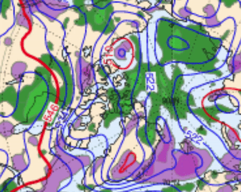
Northwards of Green delimited zone is the Polar Vortex of the entire Northern Hemisphere as expressed by NOAA 500 mb heights map December 15, 2016. Consisting of 3 vortices centers in dark purple, note to the right of each smaller vortex there is a Northward flow of air, to the left a Southward flow, yes it is cold in North America however very opposite warm NW Europe. When a TV meteorological presenter says the "Polar Vortex" is back, he or she means a single smaller vortex part of of the entire Polar Vortex system. There is apparently no single word for 'vortice', hence the confusion of using Polar Vortex. Another way of presenting the case would be to say that the Polar Vortex is weaker, hence less circular, oblong and segmented by severe warming near or towards the North Pole. A single segmented vortex usually wraps the jet stream stream around it:

December 16 2016 CMC 250 mb chart. Blue trace my own. Within the blue trace is the center of vortices, there lies a surprise, it is the Cold Temperature North Poles. The coldest air possible.

CMC 500 mb chart December 16,2016. Although ideally the temperature of the entire troposphere is found by a 600 mb chart (they are rare, can't find). We can clearly read -51 C close to Great Whale river Northern Quebec, this is the center of the coldest air in the Northern Hemisphere, note Ellesmere 1500 miles North, -30 C. At center of CTNP the winds are weak to none, similar to center of hurricane but on a mega monster scale.
It may said that it is colder further South than the Arctic, these are the days when winter builds up over the continents, the Arctic Ocean atmosphere being much warmer affects the weather every where Southwards, the term Polar Vortex should be explained more correctly because this implies a Colder very expansive Polar region, in fact its warmer at the North Pole devoid of any sun light whatsoever.WD December 16,2016
~Vortices created within, sometimes one , two 3 or 4. Move about.
"A polar vortex is an upper level low-pressure area, that lies near the Earth's pole. There are two polar vortices in the Earth's atmosphere, which overlie the North, " Wikipedia
Not only 2, there can be many vortices. This article from science alert is very good:
http://www.sciencealert.com/it-s-official-the-polar-vortex-is-back-with-a-vengeance
When there is an incursion of warmth towards the Arctic Ocean, like at the moment the vortices are pushed Southwards:

Northwards of Green delimited zone is the Polar Vortex of the entire Northern Hemisphere as expressed by NOAA 500 mb heights map December 15, 2016. Consisting of 3 vortices centers in dark purple, note to the right of each smaller vortex there is a Northward flow of air, to the left a Southward flow, yes it is cold in North America however very opposite warm NW Europe. When a TV meteorological presenter says the "Polar Vortex" is back, he or she means a single smaller vortex part of of the entire Polar Vortex system. There is apparently no single word for 'vortice', hence the confusion of using Polar Vortex. Another way of presenting the case would be to say that the Polar Vortex is weaker, hence less circular, oblong and segmented by severe warming near or towards the North Pole. A single segmented vortex usually wraps the jet stream stream around it:

December 16 2016 CMC 250 mb chart. Blue trace my own. Within the blue trace is the center of vortices, there lies a surprise, it is the Cold Temperature North Poles. The coldest air possible.

CMC 500 mb chart December 16,2016. Although ideally the temperature of the entire troposphere is found by a 600 mb chart (they are rare, can't find). We can clearly read -51 C close to Great Whale river Northern Quebec, this is the center of the coldest air in the Northern Hemisphere, note Ellesmere 1500 miles North, -30 C. At center of CTNP the winds are weak to none, similar to center of hurricane but on a mega monster scale.
It may said that it is colder further South than the Arctic, these are the days when winter builds up over the continents, the Arctic Ocean atmosphere being much warmer affects the weather every where Southwards, the term Polar Vortex should be explained more correctly because this implies a Colder very expansive Polar region, in fact its warmer at the North Pole devoid of any sun light whatsoever.WD December 16,2016
Tuesday, December 13, 2016
Dramatic Arctic Warming captured with ice extent and temperatures: Area under the DMI 80 temperature curve biggest in 2016 in direct relation to substantial daily open water area.
Average Arctic Ocean surface temperatures have a close relation to either sea ice or open water total areas.
These three measurable geophysical parameters are inseparable, they cause and effect each other to vary. The easiest one to immediately visualize is open water, dark, but warm especially in winter.
 |
| Sea ice extent variations by Cryosphere Today depict a steady downward trend, except of course for 2016 with numeric data calculation problems. Obviously absent sea ice is replaced by open sea water. The large 2007 and 2012 variations depicted above are largely due to favorable melt or compaction conditions as caused by Arctic Dipoles or rather large Cyclones mixing sea ice with already open water huge sea waves. |

The period of greater demise for Arctic sea ice started in 1998, if we integrate the space under the DMI 80 N temperature red curve vs average in green, we may get a correlation with respect to open water extent. Note 2013 the last year with expansive sea ice after minima, the red closely hugged the green more often. Note the years 2016, 2012, 2007 and 2006 being particularly ocean blue with a largest integrated temperature areas matching open water extent or are very well reversely proportional with their lowest sea ice extents. 2004 temperature area integration is close to 0 which coincides with 2004 ice extent being pretty average. The pre 1998 curves appear to have a consistent integration much closer to 0 or less:

What we may conclude from these mental integrations: there's a hard road back to normalcy for sea ice to rebuild, if not an irreversible downward extent trend particularly demonstrated by a very large, the largest under temperature curve integrated area in 2016, indicating much more open sea water, it is exceptionally foreboding. WD December 13, 2016
Friday, December 9, 2016
From warm year to warmer: A different icescape world in 5 years
Sea ice greatest feature is the recent memory it encapsulates, it is planet Earth's graph displaying not only daily but more monthly/yearly trends:

2016 has Myriads of very small leads interspersing countless thinner broken up sea ice pans. A much more fluid ice pack, not really amenable for mega lead formations. The more frozen areas of 2016 pack has some much smaller mega leads. We are very close to winter solstice, if this badly broken up sea ice pack continues till Maxima date, 2017 summer sea ice prospects look very bleak. The badly broken up sea ice state is deeply intertwined with a feedback loop enticing Cyclones to persist over the long night Arctic Ocean, these keep the sea ice from accreting normally, keeping the pack loose. This long night may be the starting time when sea ice extent variations simply will stay down year round. WD December 9,2016
Sunday, December 4, 2016
The "Perfect Storm" 1 month late minus the hurricane merge
"Here we are in the graze of winter"
John Mellencamp
the time was October 31 1991:

2016 has same winter blast, much weaker, is a coming 40 days late:

ECMWF portrays coming High pressure "Arctic dome" originating mainly from Alaska,
a pale shadow of former self, while the Arctic Ocean is currently dominated by a Cyclone which just kicked out a budding mega cold "dome" forming, the by-continental merge of cold air zones was cut in two, leaving Alaskan build up to come down the Rockies path. However, on the East coast of North America, a huge Cyclone system will blossom December 9-10 not unlike segments of the Perfect Storm of 91, but minus Hurricane Merge, December being well past hurricane season, the last one Nicole streamed by Mid-October 2016.

Last 30 days (from December 7) NOAA temperature anomaly. North America is not as cold as old November's use to be.

Saturday, November 26, 2016
Late one sided winter start, example of what thick sea ice did regularly months earlier, and what happens later when less sea ice is looser pack
We follow here the progression or regression of the first dominant Anticyclone to cover the Arctic Ocean. In the Past , Siberian cold continental air easily invaded and teamed up with the other side
of the world cold dark clear air massive buildups, the beginning of cold dark winter didn't take long to be felt by millions once they merged. Now we see first hand the further demise of early winter:

For weeks, there was no wide spanning Highs over the Arctic Ocean. Now we can surmise the numerous leads amongst thinner sea ice finally freezing. I watch carefully how strong or enforced this North Pole High will be. The cold gathered in Siberian darkness wages the spread of winter from darker lands favoring radiation to space. In Northern Canada, the Pacific and Atlantic Cyclones continue the warmth initiated by the great sea ice dispersion event of early September just past. WD November 26,2016


the push to destroy the Siberian Antiyclone. Again the Cyclones have hanged about Arctic Ocean locations which warmed the most over summer past. Coup de grace is about to finish the Siberian cold, the NW archipelago Low will pull in the Atlantic Low , soon the entire Arctic Ocean will be back to clouds and Low pressure warmth. WDNov30,2016

Thursday, November 24, 2016
Unprecedented Arctic Ocean surface Air warming and computer modeling, are they integrating the sea ice current morphology?

First the unprecedented warming bit. Autumn early winter 2016 outclasses all others. DMI North of 80 surface temperature s easily beat 1998, 2007 and 2012 by very wide margins.
We should apparently use this model to predict the next season minima with 66% confidence:

Fall 2011 DMI really didn't give a hint of the coming 2012 summer season melt. 2006 fared quite well, 2015 not so bad.
ECMWF 500mb animation, next 7 days along with 2 other models, GFS and CMC , all agree that the incoming Cyclones from the North Atlantic will not happen. Note the lack of steady position of the 500 mb Lowest thickness. 500 mb is used here to find the coldest column of air about . If the 500 mb lowest height was around Southern Greenland, there would be great flow Northwards.

Subscribe to:
Posts (Atom)